
Illustrated Outdoor Map
I designed an illustrated campus map for Earlham College’s electric vehicle charging station area, transforming the adjacent wood paneling into an engaging visual landmark. Working with the Environmental Sustainability Coordinator and the Marketing Creative Director, the goal was to create an interactive, eye-catching piece for anyone parking nearby.
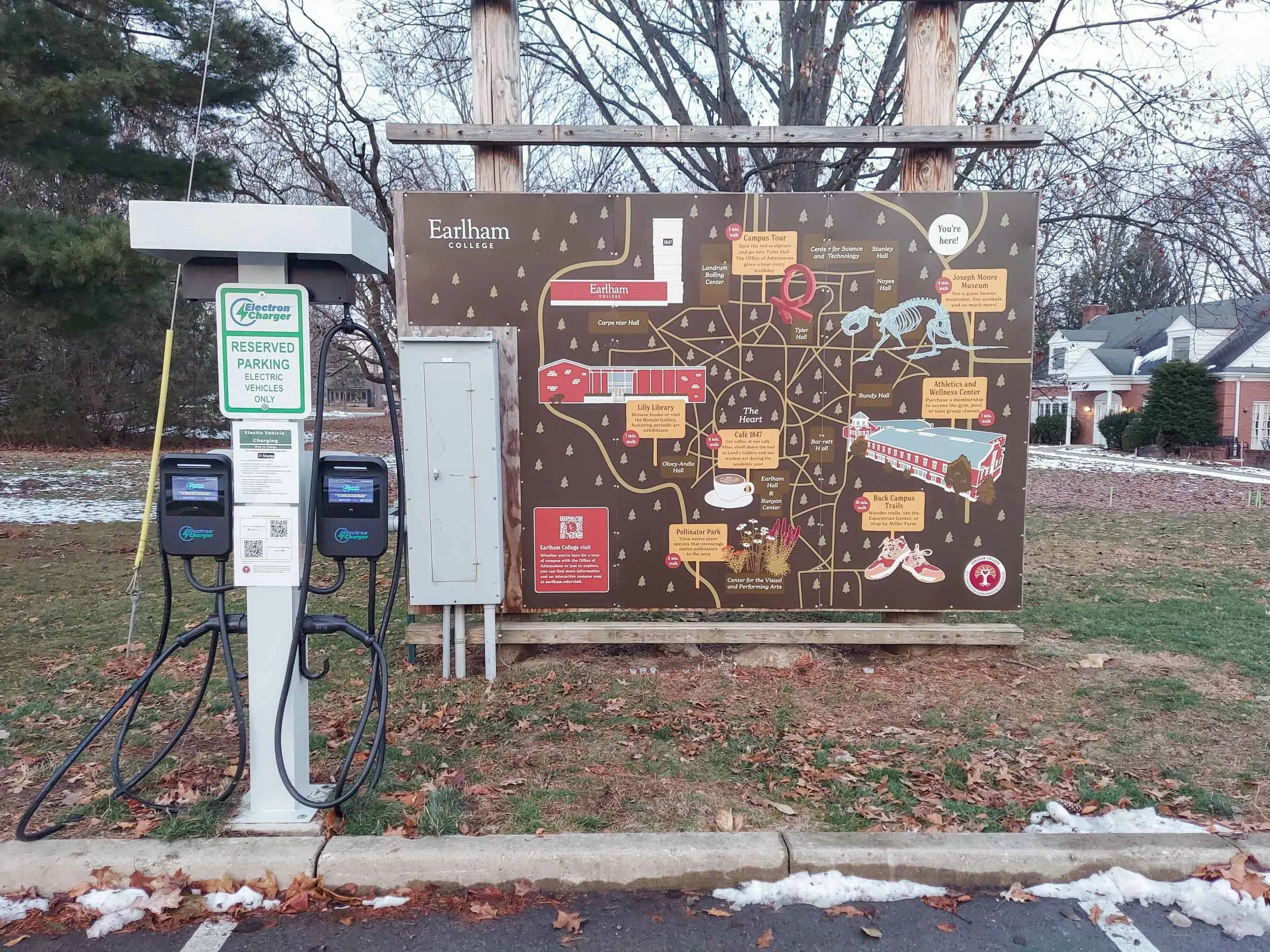
The map highlights publicly accessible parts of campus and features Earlham’s winding sidewalks to provide a sense of direction. Because Admissions visitors were also a key audience, I included a QR code linking to the visit page and the online interactive map.
I developed the layout in Photoshop, using site visits and reference photos to hand-draw each campus illustration digitally in Earlham’s brand colors. Signposts identify key locations with descriptions and walking times, while subtle background buildings add additional guidance.
After approval, we partnered with a local printing company to produce the oversized installation (145” x 96”). I collaborated with the production team to plan necessary vertical and horizontal cuts in the polystyrene to maintain design quality and fit around an electric box.
Close up
I developed the layout in Photoshop, using site visits and reference photos to hand-draw each campus illustration digitally in Earlham’s brand colors. Signposts identify key locations with descriptions and walking times, while subtle background buildings add additional guidance.